The 14th and 15th of June I had the pleasure to attend the SIG Libre conference organized by SIGTE (Servicio de Información Geográfica y Teledetección) from the Universitat de Girona. The event gathers people interested in geotechnologies and spatial data science from all over Spain. It has been a great opportunity to get to know many interesting open source technological solutions and the people behind them. During the event, I had the pleasure to represent BiciZen, and tell other geoenthusiasts about it.
Web maps as support for citizen science, Mosquito Alert
From the different talks I had the pleasure to attend, I would like to talk about the one from Rosa Olivella and Josep Sitjar from SIGTE. The talk focused on how can web maps support participative processes and citizen science initiatives. During the talk, Rosa explained four different projects where the SIGTE participated, their role and the webmapping solutions provided. After that, Josep explained the architecture behind each of the solutions. From the four projects, I was specially interested in Mosquito Alert, a citizen science project that has been collecting and analyzing mosquito images since 2014. I was very interested in how had they been able to manage all the information that had been collected over the years.
During one of the breaks, I was able to talk with some of the SIGTE members who had been working on mosquito alert. It was very interesting to know about the “superclusters” a solution to represent thousands of observations on a webmap. Another very interesting information is how the validation process works in the project. Citizens map the presence of mosquitos, experts classify the mosquitos, kids from nearby schools help find possible breeding areas and municipal authorities take actions when needed. It would be great to one day, have a similar structure in Bicizen, with different stakeholders involved working on different tasks to make city regions more bikeable.
Sharing data between BiciZen and Open Street Map
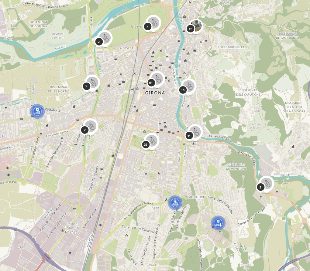
I was also able to get in touch with some of the members of the Open Street Map (OSM) community from Girona and Zaragoza, what led to import the bicycle parking locations from OSM to BiciZen. It was reassuring to know the effort that other communities and projects have put into mapping bicycle parking locations. Nonetheless, there is still work to do. During the stay, I was able to find parking locations that had not been yet added to OSM.
I hope to be able to verify all the locations imported from OSM, and add the information collected with BiciZen back to OSM, so that both projects can become more complete. The current methodology to import and export data between BiciZen and OSM may not be perfect yet, producing duplicates in some cases. Nonetheless, the tests to export the parking locations from the UAB collected with BiciZen to OSM, and the ones to import data from OSM to BiciZen are bringing better results with each iteration, what makes me optimistic about future collaborations.